Three lakes sit on one summit in central Flores. One is usually blue or black, one turquoise or jade, one red-brown. They are separated by a few hundred metres of rock, they are fed by the same volcano, and they change colour independently of each other on a schedule nobody can predict. That is Kelimutu, and it is the single most photographed natural wonder on the island that Komodo National Park belongs to.
It is also routinely misunderstood by people planning a Komodo trip, in two specific ways. The first is distance: Kelimutu is not a day trip from Labuan Bajo, it is at the other end of Flores, and the honest options are a flight or several days of driving. The second is the colours: a great many visitors arrive expecting the red-green-blue postcard and find three lakes in three shades of green, because that is what the volcano happens to be doing at the moment.
We run a dive resort in the Komodo archipelago, at the western end of the same island, and Kelimutu is the trip our guests most often ask about and most often underestimate. This guide covers what the three lakes actually are, why they change colour, what they mean to the Lio people whose ancestors are believed to rest in them, both realistic routes from Labuan Bajo, what the dawn climb is really like, what it costs in 2026, the volcano safety advice currently in force, and the altitude rule that matters if you have been diving.
What Kelimutu Actually Is
Kelimutu is a volcano in central Flores, roughly 50 kilometres east of Ende and a short drive above the village of Moni, which is where almost every visitor sleeps. The summit stands at about 1,639 metres. It sits on the Sunda Arc, the chain of volcanoes created where the Indo-Australian Plate grinds beneath the Eurasian Plate, the same tectonic engine responsible for most of Indonesia's mountains.
The volcano is protected inside Kelimutu National Park, an area of roughly 50 square kilometres of hills, mountains and montane forest. The park's highest point is not actually Kelimutu itself but neighbouring Kelibara at about 1,731 metres. Almost nobody visits the park for the forest, though, because the reason to come sits in three craters at the top.
What makes Kelimutu genuinely unusual among the world's volcanic lakes is not that it has coloured water. Plenty of crater lakes do. It is that three lakes this close together maintain completely different chemistry, and therefore completely different colours, and shift on their own individual timetables. Two of them are separated by nothing more than a narrow shared crater wall.
The Three Lakes, and the Colours You Should Not Count On
Each lake has a Lio name, and the spellings vary between sources, so do not be thrown when you see them written differently on signs and in guidebooks.
Tiwu Ata Bupu, the Lake of Old People
The westernmost lake, and the odd one out geographically. It sits in a pit crater that is itself inside a larger crater, and it is set somewhat apart from the other two, so many photographs of "the three lakes" only really show two. It is most often described as blue, sometimes deepening to near-black, though the record includes green and white as well. Its shoreline is filmed in reds, oranges and yellows depending on thickness, and gypsum crystals grow in the cracks of the crater wall above the waterline.
Tiwu Ko'o Fai Nuwa Muri, the Lake of Young Men and Maidens
The central lake, and usually the most immediately striking: turquoise, jade or a vivid green that reads sharply against bare rock. Its surface is often visibly in motion, driven by a large upwelling at the centre that pushes froth toward the crater walls. This is the lake with the most eventful modern history, and it is the one current safety advice singles out.
Tiwu Ata Polo, the Enchanted Lake
The southeastern lake, separated from the central one by a narrow partition of rock that dips to only about 35 metres above the water. This is the unpredictable one. It has been recorded as red, rust, chocolate brown, dark green and blue. A thermal plume in its northwestern corner marks hydrothermal activity below, and white froth gathers there when the convection picks up. Its shifts between dark green and deep red-brown track the change from dry season to wet, and when it turns, it can go in a matter of days, the new colour spreading inward from the crater walls.
What Colour Are the Lakes Right Now?
This is the question the photographs create and almost no guide answers, so here is the current position, and here is how to check it yourself before you commit to the trip.
Indonesia's Geological Agency monitors Kelimutu continuously and publishes visual observations. At the most recent field measurement at the time of writing, in early July 2026, all three lakes were reported in shades of green: the first crater lake turquoise green, the second light green, and the third dark green. The middle lake had held that same light green consistently since the middle of June 2026, and its water temperature had eased slightly from 35 to 33.2 degrees Celsius.
Read that again if you are picturing the postcard. At the moment there is no red lake. There is a turquoise one, a light green one and a dark green one, which is still a remarkable thing to stand over at dawn, but it is not the image that sells the trip. This is the single most useful thing we can tell you about Kelimutu, and it is why we would gently steer you away from booking several days of travel purely to photograph a colour combination.
The historical record shows how much this moves. In 1929 the enchanted lake was red, the central lake light green, the lake of elders green. By 1938 the central lake had turned white and its surface may have reached 65 degrees. Through the 1970s the enchanted lake was red again, the central lake light blue, and the lake of elders white. In 1989 and 1992 the enchanted lake was dark green, the central lake light blue, and the lake of elders black. Sixty years, and no repeat.
The practical takeaway is to go for the phenomenon rather than a particular palette, and to check the current state shortly before you travel. The government volcano portal at magma.esdm.go.id carries the latest observations, including lake colours and alert level.
Why the Colours Change
The mechanism is chemistry driven by volcanism, and the reason the lakes behave independently is plumbing.
Each crater sits above its own arrangement of vents. Subaqueous fumaroles, essentially underwater volcanic vents, push gases and heated fluid into the water from below, which is why you see upwelling and froth on the surface of the two eastern lakes. The water carries dissolved minerals, principally iron, manganese and sulphur compounds. When the balance of volcanic gas and dissolved oxygen shifts, the oxidation state of those minerals shifts with it, and the colour of the water changes accordingly. Iron in one oxidation state reads green; in another it reads red-brown. Because each crater is connected to a different set of vents and a different groundwater regime, each lake keeps its own books.
That is the honest scientific summary, and it is worth noting what it does not include: a precise predictive model. Researchers can explain why a lake turned red after it has turned red. Nobody can tell you what colour any of the three will be next April. If you see a website promising the colours for your travel dates, it is guessing.
What Kelimutu Means to the Lio People
Long before the lakes were a photograph, they were a destination for the dead. For the Lio people who live around the mountain, Kelimutu is where souls travel after death, and which lake receives you depends on who you were.
The souls of the old go to the cold water of Tiwu Ata Bupu. The souls of those who died young go to Tiwu Ko'o Fai Nuwa Muri. The souls of the wicked go to Tiwu Ata Polo, the enchanted lake, which is also the least predictable of the three, a coincidence that has done nothing to weaken its reputation. Shifts in colour are read as movement or unrest among the spirits.
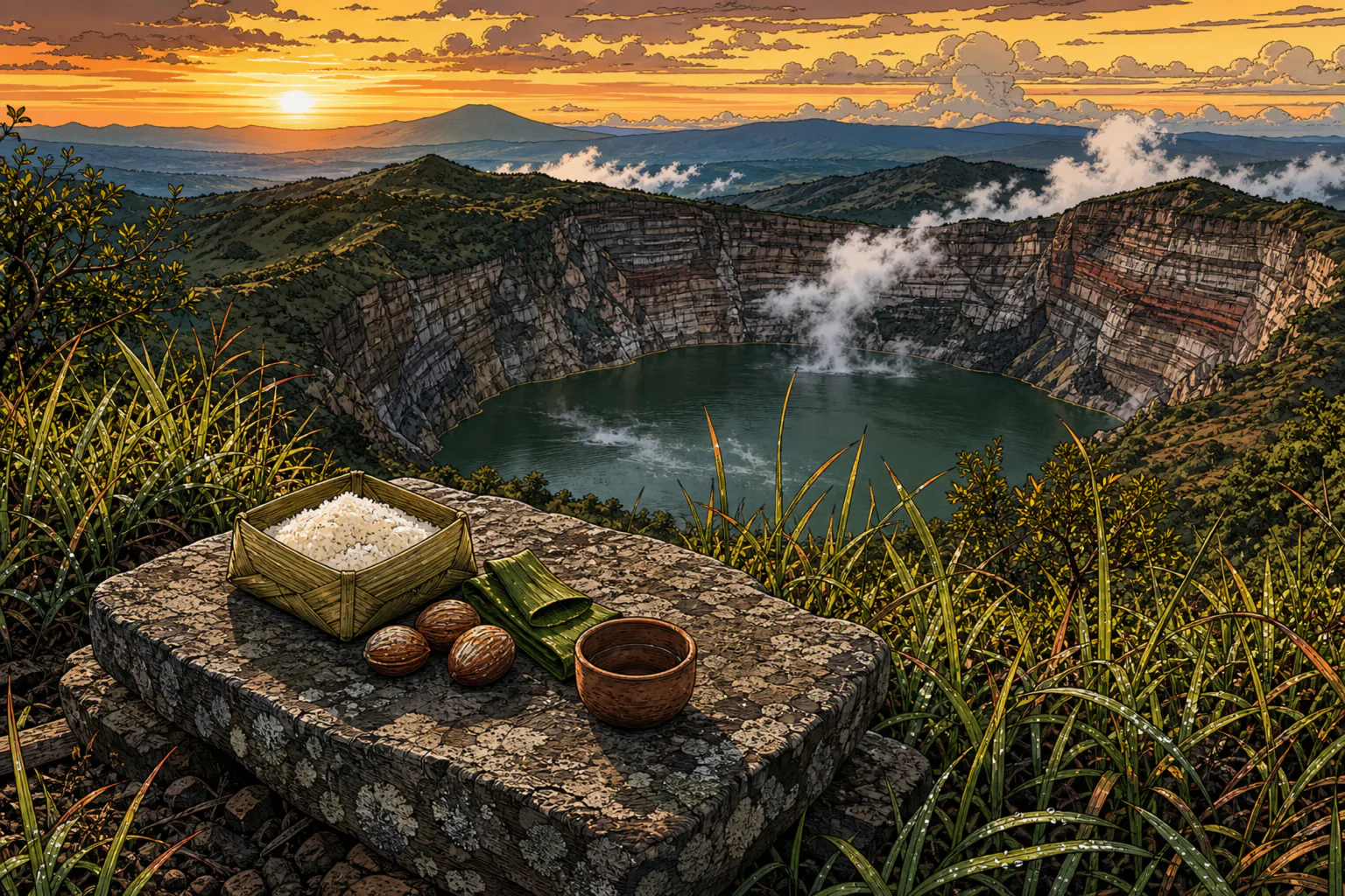
This is a living belief, not folklore preserved for visitors. Offerings of pork, betel nut, rice and other valuables are left on ceremonial stones beside the lakes, and each year on 14 August the community holds a ceremony to feed the spirits of the ancestors, known as Pati Ka Dua Bapu Ata Mata, with dancing and formal offerings. If you are at the rim on a morning when offerings are present, leave them alone and photograph them only with permission. You are standing in a cemetery that happens to be a volcano.
Getting There From Labuan Bajo: Two Honest Options
Here is where most Kelimutu plans fall apart. Labuan Bajo is at the extreme western tip of Flores. Kelimutu is in the middle of the island, closer to the south coast. There is no version of this that is a day trip, and anyone selling you one has not looked at a map.
Option One: Fly to Ende
This is the option most of our guests end up taking, and it is by far the most efficient. Wings Air flies Labuan Bajo to Ende directly in about 55 minutes on an ATR 72, roughly six to eleven times a week depending on the season, with departures in the late morning and around midday. Fares have recently sat around 55 US dollars one way. From Ende it is about an hour and a half by car or minibus to Moni; minibuses run from the Roworeke terminal roughly hourly for around IDR 50,000, though most visitors arrange a car through their guesthouse.
Because the flight lands around midday and the climb happens at dawn, the minimum realistic shape is two nights away from Labuan Bajo: fly out, drive to Moni, sleep, climb at dawn, then either fly back from Ende or continue east. Add a night if you want a weather buffer, and we would.
Option Two: The Trans-Flores Overland Journey
The other option is to treat Kelimutu as the finish line of a proper cross-island road trip along the Trans-Flores Highway, which is paved almost the whole way and slow almost the whole way. Plan on four to six days from Labuan Bajo, with five being the comfortable number, sleeping in Ruteng, then Bajawa, then Moni before the dawn climb. Expect to pay somewhere around IDR 700,000 to 900,000 a day in 2026 for a private car and driver including fuel, split between your group.
Do this and Kelimutu stops being the point and becomes the last chapter. You get the cool highlands and the spiderweb rice fields at Cancar, the volcano country and megalithic villages around Bajawa, and the option of detouring to Wae Rebo, which sits on the same road out of Labuan Bajo. Our guide to Flores covers the island as a whole if you are weighing up how much to attempt.
From Moni you do not have to double back. Maumere, three to four hours northeast, has the bigger airport and more flights; Ende is closer and to the south. Either way you have crossed Flores end to end, which is a genuinely uncommon trip. There is also a ferry-and-road combination from Labuan Bajo that takes over two days, and we mention it only so you can rule it out.
Moni, the Village at the Bottom
Moni is essentially one street wrapped in rice paddies and forested hills, about 12 to 13 kilometres below the park entrance. There are guesthouses and a handful of restaurants, it is friendly, it is cheap, and it is cold at night by Indonesian standards.
Stay two nights rather than one if you can. The reason is not comfort, it is weather. Kelimutu at dawn is frequently inside cloud, and a single morning gives you exactly one chance at a view that is not guaranteed. Two mornings roughly doubles your odds, and Moni has enough around it, waterfalls and hot springs within easy reach, to fill the day in between.
The Dawn Climb, Hour by Hour
The good news, and the reason Kelimutu suits travellers who would never normally climb a volcano: the road goes almost to the top. This is one of the most accessible volcanoes in Indonesia.
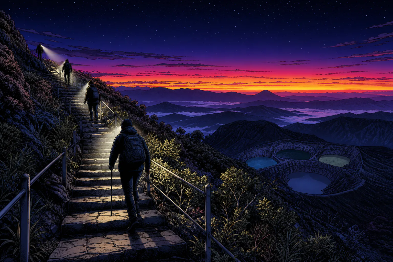
Most people leave Moni between 4am and 4.30am. The drive to the summit car park takes 30 to 45 minutes on a paved, steeply winding road, by car, scooter or ojek motorbike taxi. The park's posted hours are 5am to 6pm, and the gate opens earlier in practice, around 4.30am, for the sunrise crowd. You pay at the gate, and there is still a further kilometre or so of road beyond it to the car park.
From the car park a paved path of about 1.5 kilometres, with steps and handrails on the steeper sections, climbs to the viewpoints in 15 to 30 minutes. Take it slowly in the dark. There are several viewpoints; the highest one is where you see all three lakes at once, and it is where you want to be for sunrise. Aim to be in position by about 5.15am, since first light comes somewhere around 5.30 to 6am depending on the season, and the best spots fill up in peak months.
It is cold. Dawn temperatures at the rim can sit around 10 degrees Celsius and sometimes below, which comes as a shock to anyone who has packed exclusively for a dive holiday on the equator. Local vendors sell coffee and tea at the top, and it is very good coffee at exactly the right moment. Then the sky turns and the lakes come up out of the shadow one at a time, each one a different colour, and the four o'clock alarm stops mattering.
Volcano Safety: Stay Off the Crater Rim
This section is short, current and important, and most travel guides omit it entirely.
Kelimutu is an active volcano. At the time of writing its alert level is Level I, Normal, the lowest of Indonesia's four levels. However, the Geological Agency has explicitly and repeatedly advised visitors not to approach the crater rim, and specifically not the rim of the second crater, Tiwu Ko'o Fai Nuwa Muri, because of the risk of a sudden phreatic eruption. A phreatic eruption is a steam explosion, driven by groundwater flashing to vapour against hot rock, and its defining characteristic is that it can happen without the warning signs that precede a magmatic eruption. Level I does not mean nothing can happen; it means nothing is currently building.
The mountain has a record of exactly this. The central lake produced hydrothermal blasts in 1938 and again in 1965, each lasting more than a month, both confined within the crater. Confined within the crater is reassuring from a distance and not at all reassuring if you have climbed over a barrier for a photograph.
So: stay on the marked paths and viewpoints, stay behind the railings, and do not scramble down toward the water, however tempting the angle looks. The viewpoints are positioned where they are for a reason. Before you travel, check the current status on the Geological Agency's portal at magma.esdm.go.id, which lists alert levels and recommendations for every active volcano in the country, and follow whatever the rangers tell you on the day.
If You Are Diving in Komodo, Read This First
Kelimutu's summit is at 1,639 metres, and the roads across Flores climb higher still in places. That matters more than most divers realise.
Going to altitude after diving carries the same decompression risk as boarding an aircraft, because the mechanism is identical: ambient pressure drops while your tissues are still releasing nitrogen. The guidelines apply to any ascent above roughly 600 metres, and Kelimutu is well past double that. Notice that both routes from Labuan Bajo trigger the rule. The overland drive climbs into the highlands within a couple of hours of leaving the coast, and the alternative is literally a flight.
So apply the same intervals you would to flying home: at least 12 hours after a single no-decompression dive, 18 hours or more after multiple dives or several days of diving, and a full 24 hours as the margin we recommend to guests who have been diving repetitively. Our guide to flying after diving sets out the physiology and the numbers properly.
The elegant solution, exactly as with Wae Rebo, is to put Kelimutu at the front of your trip. Coming down from altitude to dive at sea level creates no decompression problem whatsoever; the risk only runs the other way. Watch the sunrise at Kelimutu on Monday and you can dive Batu Bolong on Wednesday without a second thought. Do it in the opposite order and you will spend your last days in Flores doing arithmetic with surface intervals. If you are not sure how it fits around your dive days, ask our team while you are still planning.
What It Costs
Fees change, so confirm before you go, but as of 2026 the shape is:
- Park entrance for foreign visitors: IDR 150,000 per person on weekdays, IDR 225,000 on weekends and public holidays. Paid in cash at the gate.
- Flight, Labuan Bajo to Ende: around 55 US dollars one way with Wings Air.
- Ende to Moni: about IDR 50,000 by minibus, considerably more for a private car.
- Private car and driver for the overland route: roughly IDR 700,000 to 900,000 per day in 2026 including fuel.
- Transport up the mountain from Moni: a modest fee for an ojek, more for a car, usually arranged through your guesthouse.
- Guesthouses in Moni: inexpensive and basic, with a few more comfortable options.
Bring small notes. Change at the gate can be limited, and Moni is not a place to rely on a card. Our guide to money and ATMs in Labuan Bajo covers drawing cash reliably before you leave the west of the island, which is what you should do.
When to Go
The dry season, roughly April to October, is the sensible window, and it overlaps neatly with the best conditions in the park, covered in our guide to the best time to visit Komodo. Clear dawns are more common, and the road up is less prone to slides.
Two seasonal notes worth knowing. Cloud is the enemy rather than rain: you can have a perfectly dry morning and still see nothing but grey, which is the argument for two nights in Moni. And if the red-brown enchanted lake is what you are hoping for, be aware its colour tracks the seasonal cycle, flipping between dark green and deep red-brown as conditions change, so the wet season shoulder months are not automatically the wrong time to go.
Sunrise is the classic experience and it is also the busiest. If crowds bother you more than atmosphere does, arriving mid-morning after the tour groups have gone gives you emptier viewpoints and flatter light.
What to Pack
This list looks nothing like the one in our Komodo packing guide, which is precisely the trap.
- Warm layers. A fleece or light down jacket and long trousers. Dawn at 1,639 metres is around 10 degrees.
- Shoes with grip. The path is paved but wet stone and steps in the dark deserve better than flip-flops.
- Headlamp or torch. Non-negotiable for the pre-dawn walk.
- Rain shell. Highland weather changes fast in any season.
- Cash in small rupiah notes for the gate.
- Water and a snack, since you will have skipped breakfast.
- A camera that handles low light, because the best minutes happen before the sun is properly up.
What Else Is Around Moni
Do not build a trip this long around ninety minutes at a viewpoint. Moni has waterfalls and hot springs within easy reach, and the drive between Ende and Moni is beautiful in its own right. Ende itself is an old Portuguese-influenced port city on the south coast with a place in Indonesian political history. Heading the other way, Bajawa is the base for the megalithic villages of the Ngada highlands and for volcanic hot springs, and Maumere on the north coast offers the larger airport for your exit.
If you are assembling a broader Indonesian itinerary, our overview of the best islands in Indonesia puts Flores in context alongside its neighbours, and how to get to Komodo explains the routes into the region including the Ende approach.
Who Should Skip It
Skip Kelimutu if your whole trip is a week or less. Between travel and the weather buffer, doing it properly costs you three days minimum, and on a short trip those days are better spent on the water and with the dragons. Our Komodo itinerary guide shows what a compact trip should actually contain.
Skip it if you specifically want the three-colour photograph and nothing else will do, because as of now the lakes are three shades of green and nobody can promise you otherwise.
Go if crossing an island interests you as much as arriving, if standing at dawn above water that a whole community believes holds its ancestors appeals, and if you have the days to spare. And note the happy exception to the usual rule about volcanoes: because the road climbs so high and the final path is short and paved with handrails, Kelimutu is achievable for many people who could never contemplate the Wae Rebo trek or a serious summit hike.
How Kelimutu Fits a Komodo Trip
Two shapes work. The first, for guests with ten days or more who want both halves of Flores: fly out to Ende early in the trip, spend two or three nights around Moni and Kelimutu, fly back to Labuan Bajo, and then give the water your full attention with no nitrogen already in your tissues. Our guide to where to stay in and around the national park covers the accommodation geography for the diving half.
The second is to make Kelimutu your exit. Dive first, respect the 24-hour interval, then drive east across the island over four to six days and fly home from Ende or Maumere. You leave Flores having seen the whole of it, which is a better ending than a shuttle back to the airport. The Labuan Bajo travel guide covers the town you will be leaving behind.
Is Kelimutu Worth It?
Yes, on one condition: go for what it is rather than for what the photographs promised. If you need a red lake beside a turquoise one to feel the trip succeeded, you are gambling several days of travel on the oxidation state of dissolved iron, and right now the odds are against you.
What you are actually going for is stranger and more durable than a colour scheme. You climb in the dark, you stand on the rim of an active volcano in the cold with a paper cup of local coffee, and as the light comes up three lakes appear below you, side by side on one mountain, each a different colour for reasons the mountain has not fully explained to anyone. Somewhere near you there may be pork and rice and betel nut left on a stone for the dead. Whatever colours you get that morning, they will be yours, and no two visitors in a hundred years have seen quite the same combination.
If you are staying with us and want help deciding whether Kelimutu fits your dates, or where it should sit relative to your diving, get in touch. We will tell you honestly if your trip is too short, because three days is a real cost and a cloudy morning is a real risk.